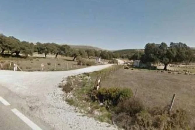
SUNP-3 Merinos Norte Parcela 1 · Ronda · Málaga

Developable Ronda land, 6.3m m²

Large developable land parcel for residential use near Ronda, with road access and rail connections to multiple cities. The listing states conflicting surface areas.

Reference can0000128724 · On Inmoblia since 16 August 2026 · Published by Aliseda

The property

Specifications

What the advert says about the property: floor area, layout, condition and registry details.

Some advert data is uncertain

We show the source-reported value for context, but exclude it from calculations until the conflicting evidence is resolved.

Type
Land
Fittings

Fittings and extras

What the property comes with and how much each item weighs in the “Property data” sub-score.

The advert also mentions:

  • Residential use
  • Rural estate description
  • Adjacent to the A-367 regional road
  • 9.5 km from Ronda town centre
  • 2.5 km from Cuevas del Becerro
  • Rail connections to Algeciras, Málaga, Antequera, Granada, Córdoba and Madrid
  • Additional stated estate area of 7311654 m²

Free text we could not normalise into a comparable attribute, so it does not score.

No buy-to-let analysis

This is a plot of land: it produces no rental income, so we calculate no yield, no rental mortgage and no buy-to-let score. Below you will find the municipal context and the plot's details.

Municipal momentum

Where the local market is heading.

Rent price index

INE · 2011 base = 100 · yearly

+3.4% interanual
120.7 20112014201820212024 105.3 · 2011105.3 · 2011104.5 · 2012104.5 · 2012103 · 2013103 · 2013101.1 · 2014101.1 · 2014100 · 2015100 · 2015102.4 · 2016102.4 · 2016103.3 · 2017103.3 · 2017105.3 · 2018105.3 · 2018107.5 · 2019107.5 · 2019108.5 · 2020108.5 · 2020110.4 · 2021110.4 · 2021113.4 · 2022113.4 · 2022116.8 · 2023116.8 · 2023120.7 · 2024120.7 · 2024

Housing transactions

MIVAU · deals per year

+2.5% interanual
535 20112015201820222025 202 · 2011202 · 2011318 · 2012318 · 2012201 · 2013201 · 2013206 · 2014206 · 2014255 · 2015255 · 2015268 · 2016268 · 2016333 · 2017333 · 2017375 · 2018375 · 2018488 · 2019488 · 2019297 · 2020297 · 2020413 · 2021413 · 2021477 · 2022477 · 2022503 · 2023503 · 2023522 · 2024522 · 2024535 · 2025535 · 2025

These series describe the municipality's housing market; for this asset they are context for the area, not for its own segment.

Investment guide for Ronda

Municipal demand

The structural depth of demand in the area.

+1.1%Rent trajectory
0 = flat average annual growth of the municipal rent index (INE)
17%Unemployment rate (approx.)
median 10% unemployed over unemployed + social security contributors (a proxy comparable across municipalities)
+9.7‰Net migration
median 11.9‰ arrivals minus departures from abroad per 1,000 residents · a growing population sustains demand

Registered unemployment

SEPE · yearly average

−11.1% interanual
2,180 20192021202320242026 3,261 · 20193,261 · 20193,979 · 20203,979 · 20203,738 · 20213,738 · 20213,165 · 20223,165 · 20222,923 · 20232,923 · 20232,710 · 20242,710 · 20242,453 · 20252,453 · 20252,180 · 20262,180 · 2026

Average gross income

AEAT · annual tax return

+4.9% interanual
€26,258 20132016201820212023 €20,514 · 2013€20,514 · 2013€20,473 · 2014€20,473 · 2014€21,281 · 2015€21,281 · 2015€21,809 · 2016€21,809 · 2016€22,266 · 2017€22,266 · 2017€22,845 · 2018€22,845 · 2018€23,505 · 2019€23,505 · 2019€22,828 · 2020€22,828 · 2020€23,849 · 2021€23,849 · 2021€25,031 · 2022€25,031 · 2022€26,258 · 2023€26,258 · 2023

Registered population

INE · yearly population register

0.0% interanual
33,671 20112014201820222025 36,793 · 201136,793 · 201136,793 · 201136,793 · 201136,698 · 201236,698 · 201236,698 · 201236,698 · 201236,665 · 201336,665 · 201336,665 · 201336,665 · 201336,208 · 201436,208 · 201436,208 · 201436,208 · 201435,676 · 201535,676 · 201535,676 · 201535,676 · 201534,381 · 201634,381 · 201634,381 · 201634,381 · 201634,268 · 201734,268 · 201734,268 · 201734,268 · 201733,978 · 201833,978 · 201833,978 · 201833,978 · 201833,877 · 201933,877 · 201933,877 · 201933,877 · 201933,730 · 202033,730 · 202033,730 · 202033,730 · 202033,624 · 202133,624 · 202133,624 · 202133,624 · 202133,401 · 202233,401 · 202233,401 · 202233,401 · 202233,329 · 202333,329 · 202333,329 · 202333,329 · 202333,451 · 202433,451 · 202433,451 · 202433,451 · 202433,671 · 202533,671 · 202533,671 · 202533,671 · 2025

Net international migration

INE · immigration − emigration · yearly

+24.9% interanual
326 2021202220232024 115 · 2021115 · 2021160 · 2022160 · 2022261 · 2023261 · 2023326 · 2024326 · 2024

Recorded offences

Ministry of the Interior · cumulative

+77.0% interanual
3,271 202420252026 436 · 2024436 · 2024823 · 2024823 · 20241,195 · 20241,195 · 20241,532 · 20241,532 · 20241,848 · 20251,848 · 20252,201 · 20252,201 · 20252,625 · 20252,625 · 20252,959 · 20252,959 · 20253,271 · 20263,271 · 2026

Recorded offences (municipalities over 20,000 residents only, from 2024) are territorial context: they do not label an area “safe” or “unsafe”, nor do they measure tenant risk.

This is a shortlisting pass over the advert's data, not a due diligence report. Before deciding, check the points we cannot verify from here:

  • Planning classification and real buildable area: confirm both with the town hall before anything else.
  • Available services and connections (water, electricity, drainage, vehicle access).
  • The real service charge and, above all, whether any special levies are approved or pending: they appear in the minutes of the last owners' meetings.
  • The property's actual IBI: our figure is an estimate from the municipality's cadastral values, not the specific bill.
  • Charges, mortgages, seizures or easements in the Land Registry extract.