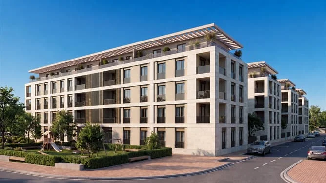
Bugallido · Ames · A Coruña

Developable land near Bertamiráns, 10,568 m²

Residential development land in Ames with 10,568 m² of stated buildability. The site has approved partial planning, reparcelation and urbanisation projects.

Reference ali0000144252 · On Inmoblia since 16 August 2026 · Published by Aliseda

The property

Specifications

What the advert says about the property: floor area, layout, condition and registry details.

Some advert data is uncertain

We show the source-reported value for context, but exclude it from calculations until the conflicting evidence is resolved.

Type
Land
Land classification
Developable land
Buildable area
10,568 m²
Fittings

Fittings and extras

What the property comes with and how much each item weighs in the “Property data” sub-score.

The advert also mentions:

  • Residential use
  • Collective open residential zoning
  • Sector S-20
  • Approved partial planning
  • Approved reparcelation project
  • Approved urbanisation project
  • Nearly flat terrain
  • Urban area with nearby services
  • Adjacent to the Sar river promenade

Free text we could not normalise into a comparable attribute, so it does not score.

No buy-to-let analysis

This is a plot of land: it produces no rental income, so we calculate no yield, no rental mortgage and no buy-to-let score. Below you will find the municipal context and the plot's details.

Municipal momentum

Where the local market is heading.

Rent price index

INE · 2011 base = 100 · yearly

+5.0% interanual
121.8 20112014201820212024 107.3 · 2011107.3 · 2011105.6 · 2012105.6 · 2012103.1 · 2013103.1 · 2013101 · 2014101 · 2014100 · 2015100 · 2015100.6 · 2016100.6 · 2016101.5 · 2017101.5 · 2017102.9 · 2018102.9 · 2018105.7 · 2019105.7 · 2019107.4 · 2020107.4 · 2020109.6 · 2021109.6 · 2021112.9 · 2022112.9 · 2022116 · 2023116 · 2023121.8 · 2024121.8 · 2024

Housing transactions

MIVAU · deals per year

+2.7% interanual
384 20112015201820222025 187 · 2011187 · 2011267 · 2012267 · 2012165 · 2013165 · 2013218 · 2014218 · 2014217 · 2015217 · 2015189 · 2016189 · 2016237 · 2017237 · 2017268 · 2018268 · 2018287 · 2019287 · 2019265 · 2020265 · 2020363 · 2021363 · 2021352 · 2022352 · 2022329 · 2023329 · 2023374 · 2024374 · 2024384 · 2025384 · 2025

These series describe the municipality's housing market; for this asset they are context for the area, not for its own segment.

Investment guide for Ames

Municipal demand

The structural depth of demand in the area.

+1.0%Rent trajectory
0 = flat average annual growth of the municipal rent index (INE)
9%Unemployment rate (approx.)
median 10% unemployed over unemployed + social security contributors (a proxy comparable across municipalities)
+7.6‰Net migration
median 11.9‰ arrivals minus departures from abroad per 1,000 residents · a growing population sustains demand

Registered unemployment

SEPE · yearly average

−1.4% interanual
1,160 20192021202320242026 1,816 · 20191,816 · 20192,041 · 20202,041 · 20201,803 · 20211,803 · 20211,578 · 20221,578 · 20221,419 · 20231,419 · 20231,268 · 20241,268 · 20241,176 · 20251,176 · 20251,160 · 20261,160 · 2026

Average gross income

AEAT · annual tax return

+3.3% interanual
€30,560 20132016201820212023 €24,145 · 2013€24,145 · 2013€24,054 · 2014€24,054 · 2014€24,619 · 2015€24,619 · 2015€24,978 · 2016€24,978 · 2016€25,618 · 2017€25,618 · 2017€26,175 · 2018€26,175 · 2018€26,866 · 2019€26,866 · 2019€26,810 · 2020€26,810 · 2020€27,853 · 2021€27,853 · 2021€29,583 · 2022€29,583 · 2022€30,560 · 2023€30,560 · 2023

Registered population

INE · yearly population register

0.0% interanual
33,276 20112014201820222025 28,852 · 201128,852 · 201128,852 · 201128,852 · 201129,331 · 201229,331 · 201229,331 · 201229,331 · 201229,689 · 201329,689 · 201329,689 · 201329,689 · 201329,975 · 201429,975 · 201429,975 · 201429,975 · 201430,267 · 201530,267 · 201530,267 · 201530,267 · 201530,544 · 201630,544 · 201630,544 · 201630,544 · 201630,835 · 201730,835 · 201730,835 · 201730,835 · 201731,278 · 201831,278 · 201831,278 · 201831,278 · 201831,793 · 201931,793 · 201931,793 · 201931,793 · 201932,104 · 202032,104 · 202032,104 · 202032,104 · 202031,993 · 202131,993 · 202131,993 · 202131,993 · 202132,095 · 202232,095 · 202232,095 · 202232,095 · 202232,482 · 202332,482 · 202332,482 · 202332,482 · 202332,812 · 202432,812 · 202432,812 · 202432,812 · 202433,276 · 202533,276 · 202533,276 · 202533,276 · 2025

Net international migration

INE · immigration − emigration · yearly

−4.9% interanual
252 2021202220232024 170 · 2021170 · 2021378 · 2022378 · 2022265 · 2023265 · 2023252 · 2024252 · 2024

Recorded offences

Ministry of the Interior · cumulative

+88.0% interanual
2,476 202420252026 311 · 2024311 · 2024589 · 2024589 · 2024833 · 2024833 · 20241,087 · 20241,087 · 20241,317 · 20251,317 · 20251,615 · 20251,615 · 20251,915 · 20251,915 · 20252,157 · 20252,157 · 20252,476 · 20262,476 · 2026

Recorded offences (municipalities over 20,000 residents only, from 2024) are territorial context: they do not label an area “safe” or “unsafe”, nor do they measure tenant risk.

This is a shortlisting pass over the advert's data, not a due diligence report. Before deciding, check the points we cannot verify from here:

  • Planning classification and real buildable area: confirm both with the town hall before anything else.
  • Available services and connections (water, electricity, drainage, vehicle access).
  • The real service charge and, above all, whether any special levies are approved or pending: they appear in the minutes of the last owners' meetings.
  • The property's actual IBI: our figure is an estimate from the municipality's cadastral values, not the specific bill.
  • Charges, mortgages, seizures or easements in the Land Registry extract.